Disclaimer: Any views expressed by individuals and organisations are their own and do not in any way represent the views of The Heritage Portal. If you find any mistakes or historical inaccuracies, please contact the editor.
The article below explores the early history of Johannesburg, from the discovery of gold on the Witwatersrand to the establishment and development of the city's first neighbourhoods. Dr. Oscar Norwich, a noted Johannesburg historian and collector, captures the rapid transformation of a mining settlement into one of the world's great cities. The piece was originally published in a 1975 edition of "Behind the Chains", the journal of the Johannesburg Historical Foundation. Thank you to the Norwich family for their kind permission to publish this article from Dr. Norwich's archives.
The development, growth and progress in so short a space of time in the life of one of the great cities of the World is unparalleled. Prior to the discovery of the main gold reef on the Witwatersrand many attempts as far back as 1834 were made to seek this precious metal, in many other parts of the Transvaal. In Lydenburg, gold deposits were found during the regime of President Burgers the second President of the South African Republic. In the Eastern Transvaal districts of Pilgrims Rest and Barberton, payable gold was discovered from 1873.
Old photo of Barberton
After the occupation of the Transvaal by the British from 1877 to 1881, it reverted back to a self governing Republic which was ruled temporarily by a triumvirate of Paul Kruger, Piet Joubert and Marthinus Wessels Pretorius until Kruger was elected its first President.
At this period the Kimberley diamond fields were yielding fortunes. It was in this atmosphere that the dramatic story of the discovery of gold on the Witwatersrand began.
This discovery is linked with the names of the Oosthuizen Family; the Struben Brothers; Bantjes; George Walker and George Harrison. It is now almost certainly established that George Harrison was the recognised discoverer of the gold outcrop in Langlaagte not far from the widow Oosthuizen's portion of her farm where he was employed as a handyman. This long and somewhat complicated story was unravelled by those undefatigable researchers and documented by Mr and Mrs James Gray in their book "Payable Gold" and other publications. They established that Harrison was granted the Zoeker's Claim Langlaagte No.19 by the Government and that Walker was awarded the ordinary claim Langlaagte No.21. These original claim sites can still be seen on the Harrison Park site named after him.
The Discovery Site at George Harrison Park (Gavin Whitfield)
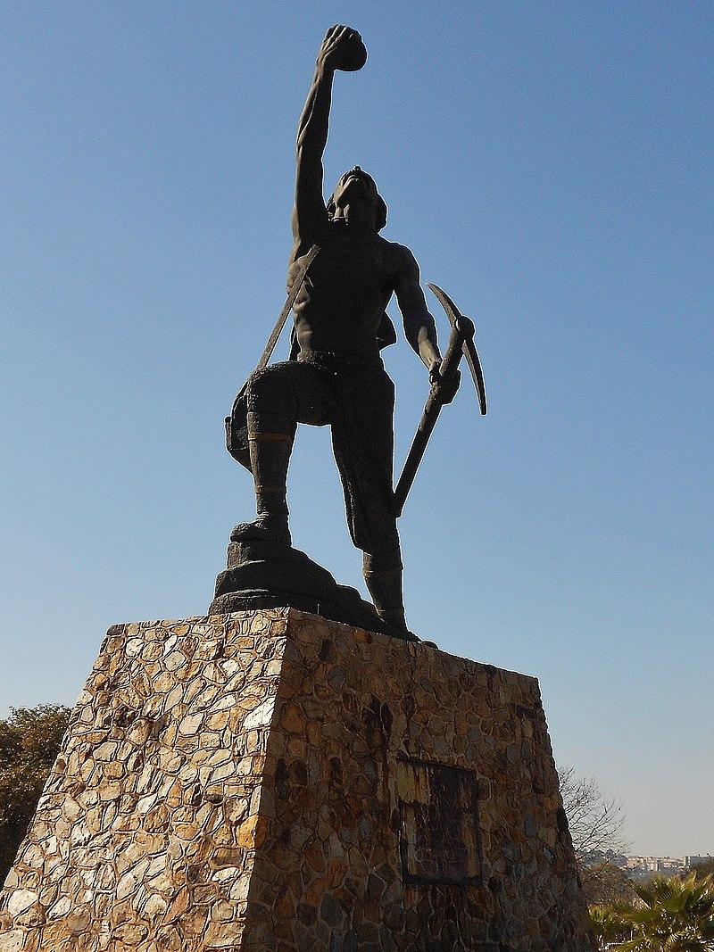
George Harrison statue next to Eastgate Shopping Centre commemorating the discovery of gold (Wikipedia)
The scene was now set for the establishment of what was to become Johannesburg. At that period the Witwatersrand was surrounded by the adjoining farm of Braamfontein to the West; Doornfontein on the East; Turffontein to the South and lastly Rantjeslaagte. Wedged between these farms was a somewhat triangular portion of ground known as "Uitvalgrond" (no man's land) which was that portion of land left after the somewhat crude and inaccurate survey of those days of these adjoining farms.
With the discovery of gold, certain Gold Laws had already been laid down by the Transvaal Republic as it was necessary for the authorities to proclaim some semblance of order for an anticipated Goldrush. J.F.B. Rissik the acting Government Surveyor-General was sent, with the then Minister of Mines C.J. Joubert early in August 1886 to report back to the Government before these Goldfields were finally proclaimed. They recommended that this piece of Government owned property then known as Rantjeslaagte would be a suitable site for a township. The Government adopted the report and on the 16th August 1886 a notice appeared in the Government Gazette informing the public that certain farms were to be proclaimed as public diggings and invited interested parties to secure rights within one month. On the 8th September 1886 President Kruger signed the proclamation. This page in the "Staat's Courant of the Zuid Afrikaansche Republiek" can be truly regarded as Johannesburg's Birth Certificate for it was on Rantjeslaagte (as it was named on the proclamation) that the city of Johannesburg was first conceived.
Rantjeslaagte, the original village of Johannesburg, was a triangle in shape approximately six miles long and half a mile at its widest. The apex is today situated on a spot where Banket Street meets East Avenue in Hillbrow/Parktown. A small portion of the original Beacon marking the Northern apex still exists on its original site suitably restored by the Johannesburg Municipality as a National Monument. The base of this triangle runs along what is now Commissioner Street- the western point at its junction with West Street and the eastern point where Commissioner Street meets End Street, thus appropriately named. The original beacons sited on these two latter sites were long missing until the Johannesburg City Council wisely reconstructed suitably inscribed pedestals on these sites in 1946- the 60th anniversary of the proclamation.
A more recent commemoration of the Randjeslaagte Beacon (The Heritage Portal)
Having established Rantjeslaagte, the Government then decided to establish an official Township and instructed a Mr. Jos de Villiers, the then Government surveyor, to survey and lay out this site. On the 4th November of that year he reported the establishment of 748 stands 50 feet square in the Township. By this time however there had been more than 600 applications to acquire plots so he added another 238 stands making a total of 986. They were to be sold on a 99 year lease with a monthly stand licence of 10/- each.
As was the custom with planning an early town of the Transvaal, a large square was initially sited as the Market Square and a grid of streets planned around on all four sides for the developing community.
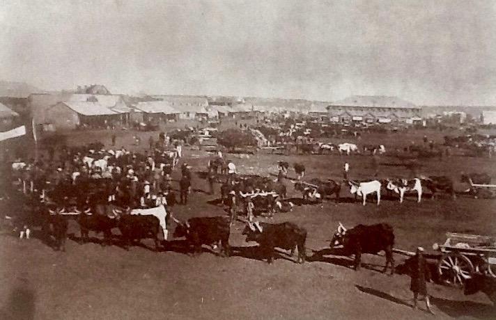
An early photograph of Market Square
There are many vivid descriptions of the first sale of these plots, L.F. Neame a veteran journalist tells us in his book on old Johannesburg that the sale commenced on the 8th December 1886 lasting three days. The first stand to be put up for auction was No. 469 (identified recently at the corner of Pritchard and Diagonal Streets). The first bid was 2/6, the next offer £1 and eventually it was knocked down for £10-17-6. The next price received were for 25 stands around the large Market Square selling for £200-£300 each. The estimated total amount realised was £13,000. It is recorded that a well known business man of Pretoria Mr. Thomas W. Beckett drove in a Cape cart from Pretoria to acquire what was the largest individual purchase of 5 stands in President Street south of the Market Square for £1,005. It is also recorded that a Mr. Alex Hope Baillie bought the site of the present Central News Agency (C.N.A.) in Commissioner Street for 10/- but after about 6 months abandoned it as it was not worth the monthly licence!
The earliest residential suburbs were established to the East, West and South of the Market Square. Doornfontein and Jeppestown were first laid out to the East and South East and Parktown later in the North. Johannesburg was now the focal point of a goldrush with the influx of many colourful and enterprising personalities. They came not only from within the borders of South Africa but in boatloads from the United Kingdom, Europe and the U.S.A.- in fact from the rest of the World.
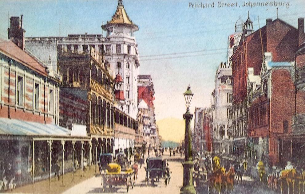
The population grew rapidly including a variety of personalities, prosperous traders, capitalists, mechanics, artisans and speculators. Many settled in the very early tent settlement in Ferreira's Camp on the farm Turffontein, then sited outside of the jurisdiction of Randjesjaagte and also in Natal Camp more to the Eastern part of the rapidly growing town. As streets were named and developed so buildings were erected particularly in Commissioner Street where the earliest multistory buildings appeared- Corporation Building, Aegis Building and the earliest Corner House- Eckstein Building. Shopping Centres soon emerged in fashionable Pritchard Street which was to become the "Regent Street" of Johannesburg.
Postcard of Pritchard Street in the early 20th century (A Johannesburg Album)
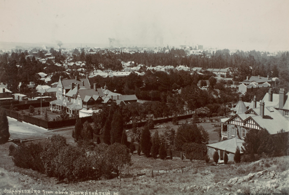
To accommodate the growing population occupied in mining and trading and the professions, residential suburbs were established in Doornfontein, Jeppestown and Fordsburg. Doornfontein was laid out in 1889 and it was here that the early pioneering Randlords established their fashionable residences. The Beits, the Barnatos, the Joels, Dale Lace, Height, Fox, Albu, Cecil Rhodes and his brother Frank were just a few of the more prominent personalities to set up houses in Doornfontein. To the South East the Township of Jeppestown was established, catering particularly for the artisan class of the busy mining activities in the South.
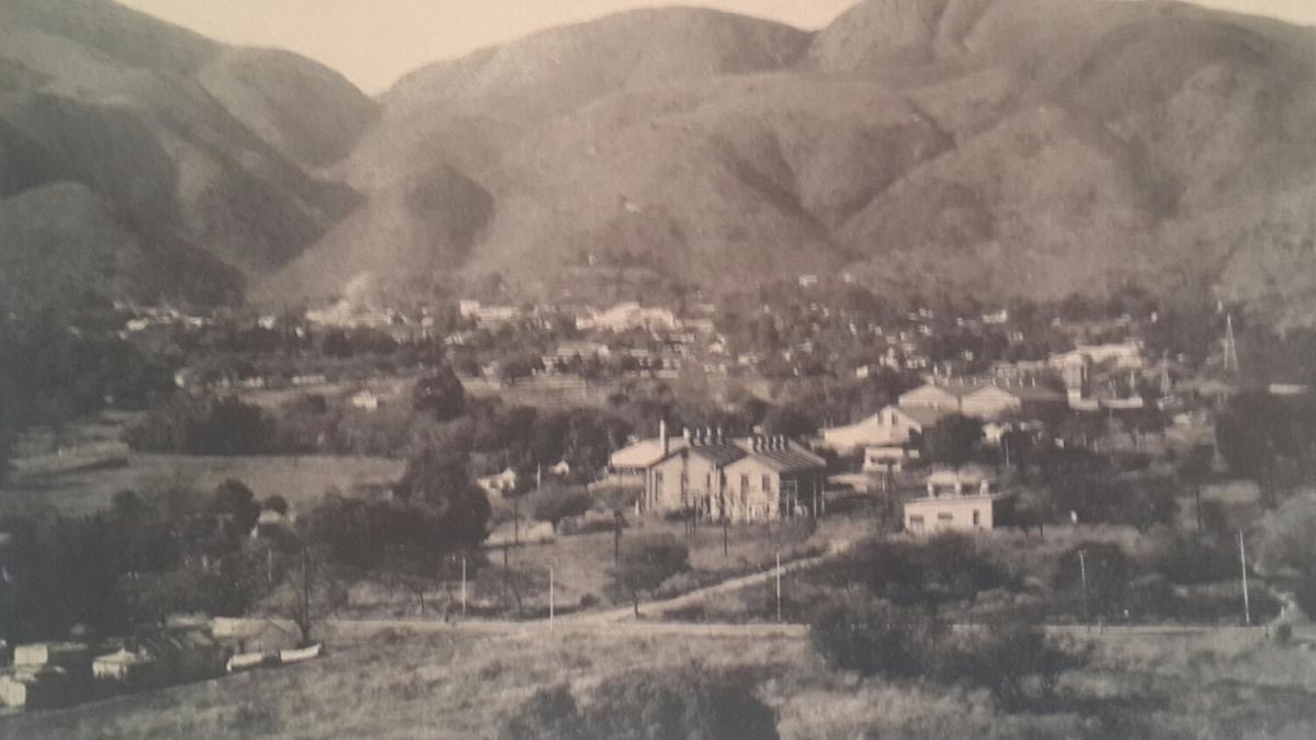
A view over some of the mansions of early Doornfontein
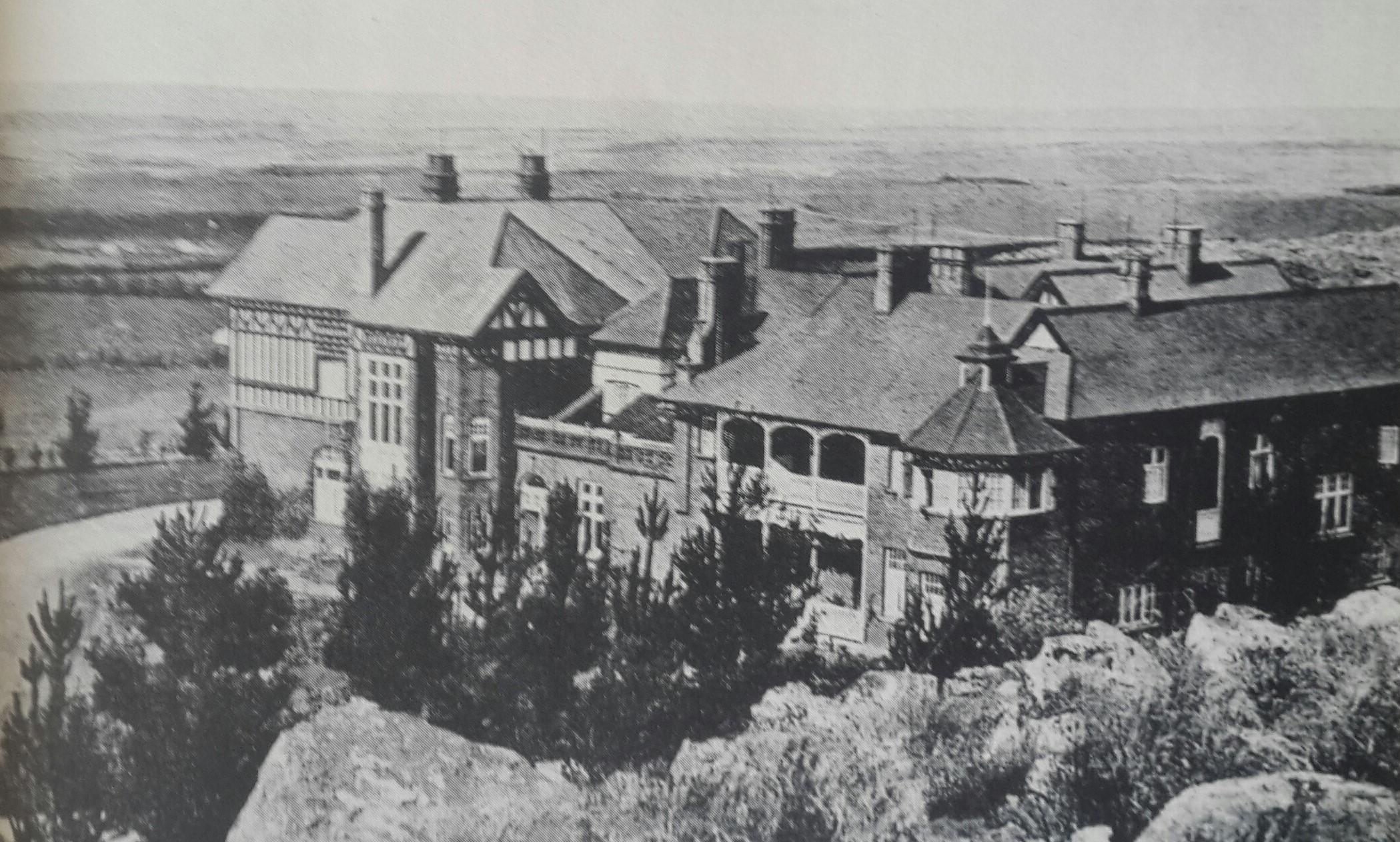
As the wealth of the town increased and the riches flowed from the Gold Mines, the so called elite decided to seek more fashionable suburbs with large plots for the erection of more comfortable mansions. The Northern ridge of the town was chosen and in 1893 four years after the establishment of Doornfontein, the Parktown Township was established by the increasingly powerful mining group controlled by Eckstein; Alfred Beit and others. This was really the second and more fashionable phase of the residential areas of Johannesburg. Parktown was intended to be a more superior part with wider roads and a more orderly attempt at logical town planning.
Hohenheim on the Parktown Ridge
Johannesburg was now set to develop uninterruptedly as a great mining and industrial metropolis. Its history was varied and turbulent, but it has today developed into one of the great cities of the world.
About the author: Dr. Oscar Norwich was a medical doctor and passionate collector who focused on African maps and Johannesburg history. As founder of the Johannesburg Historical Foundation, he led city tours and tirelessly sought rare historical items related to Johannesburg. In 1986, he published a large folio-sized book of his Johannesburg postcard collection to commemorate the city's centenary. Norwich also authored several books on African and Southern African maps. His significant map collection was eventually acquired by Stanford University in the USA, though it remains accessible to scholars online.
Comments will load below. If for any reason none appear click here for some troubleshooting tips. If you would like to post a comment and need instructions click here.

