Disclaimer: Any views expressed by individuals and organisations are their own and do not in any way represent the views of The Heritage Portal. If you find any mistakes or historical inaccuracies, please contact the editor.
A few weeks ago I was privileged to be invited by Clive Chipkin to join his Joburg tour for a group of visiting American students from Brown University, USA. The group of 22 postgraduate students spent a week in Johannesburg at the Public Affairs Research Institute (PARI) in Parktown. Hats off to Brown for devising a study abroad programme on the complexities of South Africa beyond 1994 and its transition to democracy.
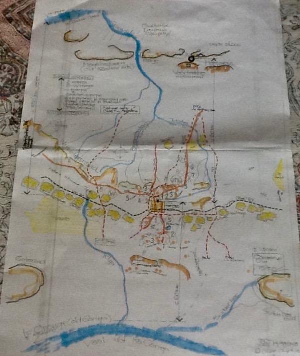
Clive Chipkin devised a personal tour to place Johannesburg in the context of its natural topography, the Witwatersrand. His tour reached across the grandest of hill top sites of the Witwatersrand. Evidence of Clive’s macro thinking has already been presented on the Heritage Portal in his 2015 heritage survey of the Corridors of Freedom, prepared for the City of Johannesburg (click here to view). Clive expresses conceptual thinking in visual diagrams about place and space. He seeks viable architectural solutions for future settlement patterns in the city. For this special Brown student tour Clive drew two maps. The first map set out our specific route with the starting point as the Gauteng Legislature (of course we still call it the Johannesburg City Hall) and ended at the Cottesloe hill. The route allowed for four stopping points on the high points of Johannesburg’s Witwatersrand ridges. The second map places Johannesburg in a geographical context relating Witwatersrand hills ridges and rivers within Gauteng.
Tour route map (Clive Chipkin)
Hand drawn map showing Johannesburg in context (Clive Chipkin)
This tour of the city relates geography, geology, economics, history and town planning in a sociopolitical framework. The objective is to give a sense of place among the Witwatersrand outcrops, rocks and ridges.
Some key questions pop up: How was the mining town superimposed on the 19th century Highveld farms and what happened thereafter? Who were the people who inhabited these hillsides prior to modernization, economic progress, the arrival of sizeable numbers of people and mining? What part did colonialism, a segregationist thinking, apartheid and new forms of political empowerment play shaping the city over 130 years? What made Johannesburg what it was and now is through each phase of its history - from gold mining camp, through Edwardian town, to the cosmopolitan African city of today?
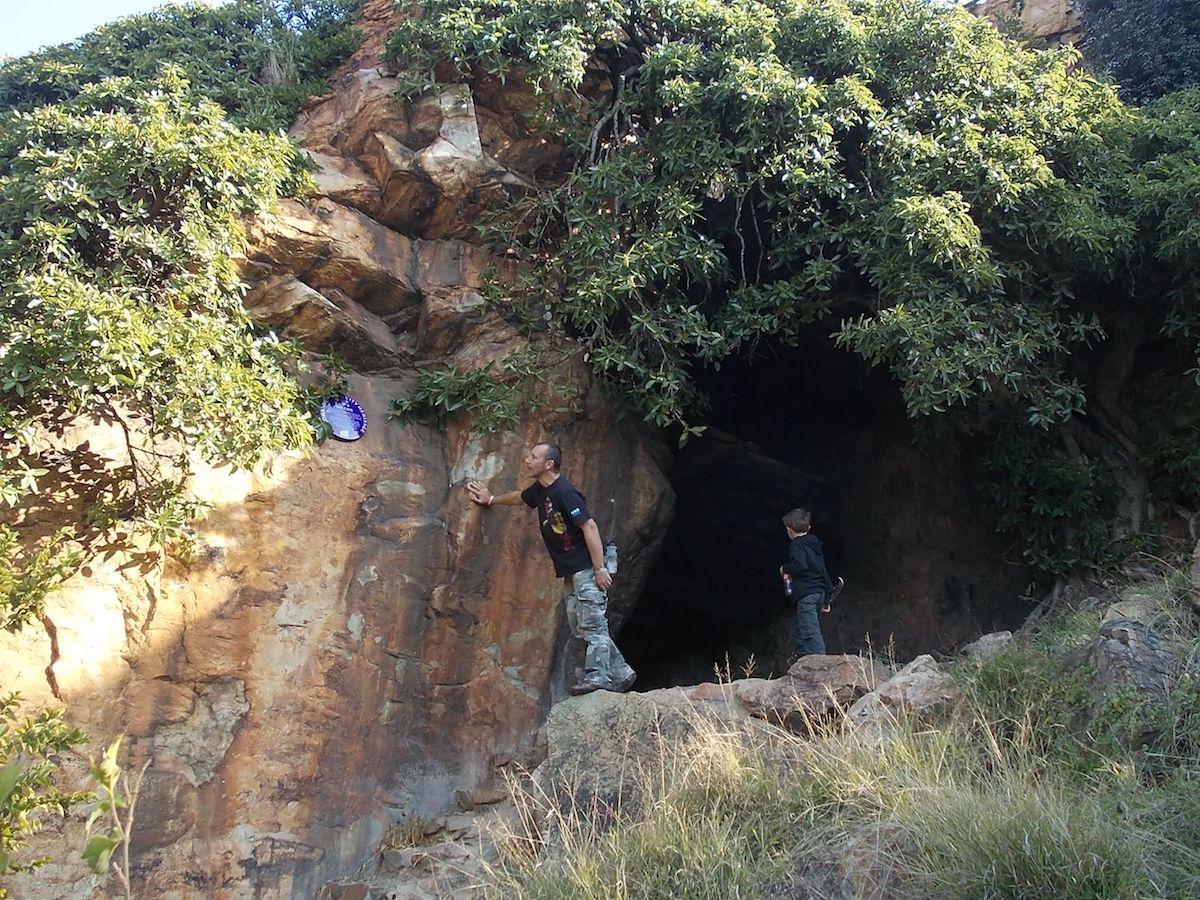
The layout of the original farms and the position of the uitvalgrond or Randjeslaagte has to be the starting point for the coming of modern man, the discovery of gold and city growth. But the archaeological evidence on the Witwatersrand shows far earlier settlements of iron manufacturing people.
Evidence of earlier human settlement can be found in the famous Melville Koppies cave (The Heritage Portal)
Clive wanted the visitors to feel the challenge of the landscape and how geology and geography impacted on settlements. The route traverses the rock faces of the Witwatersrand koppies. In an afternoon you can see and feel the stones of our history. Roads have been cut through the quartz and shale of the Witwatersrand and people have built houses in valleys, on hillsides and on top of the ridges. Early settlers came here to find gold. The making and losing of fortunes was the economic driver of where people lived and worked. Here was a place with gold in outcrops which then dipped south beneath the surface of the veld - this was where a city was founded.
We notice and comment on the fact that the mine dumps / tailings dumps are so much less prominent today than in the past. Johannesburg is a place where preserving and restoring the mined environment meant little to those who came to exploit the wealth of the Rand. Today, you can still see a few golden sand mountains but now those dumps are being re-mined and reprocessed for hidden gold and uranium. The evidence of all those mines to the south of the town which so defined the sense of place of Johannesburg are on their way to extinction.
Top Star Mine Dump being reclaimed (Rod Kruger)
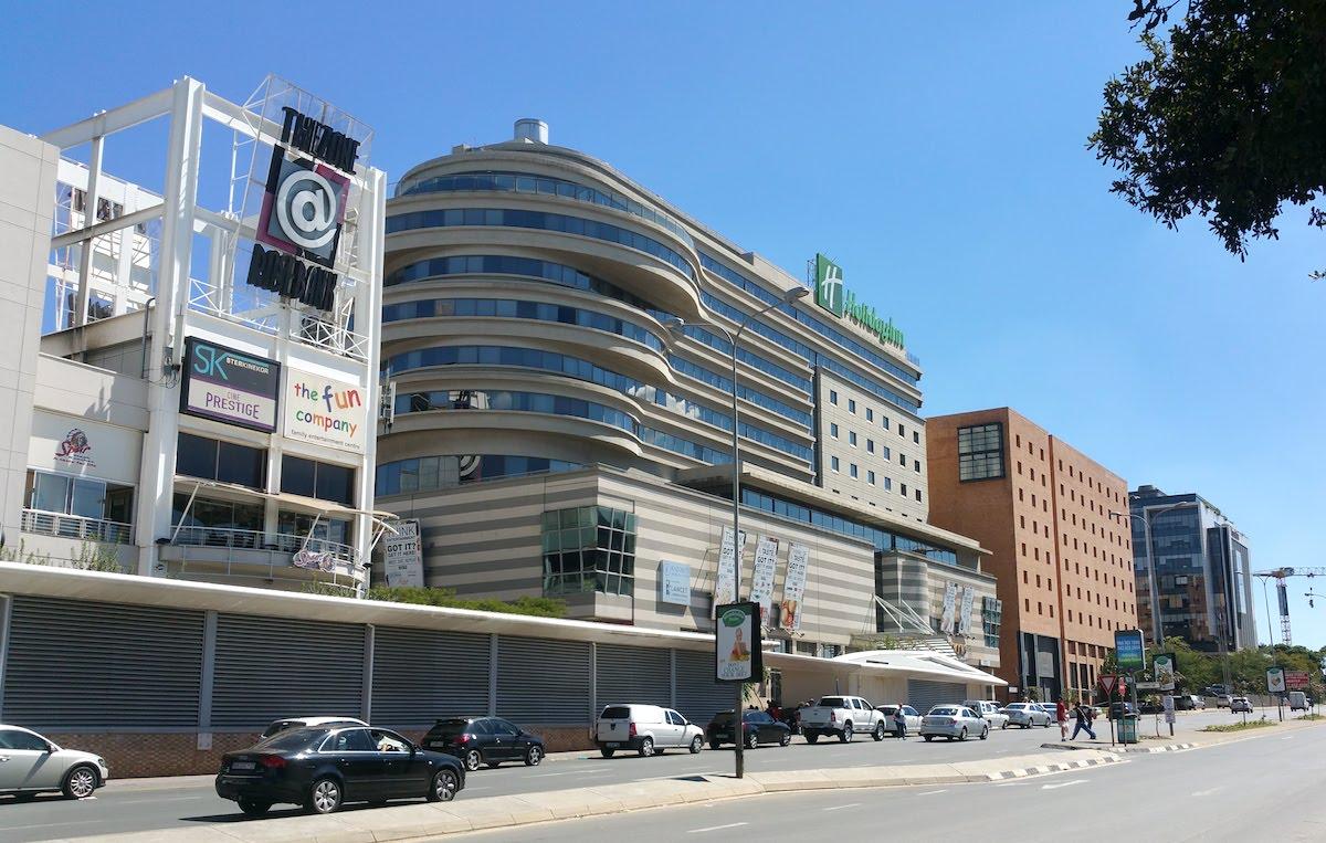
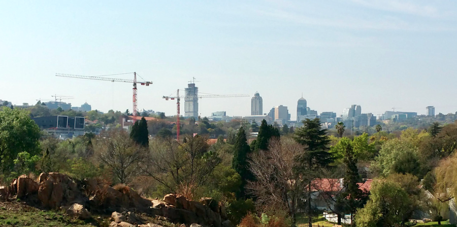
The other striking impression is that Johannesburg sprawls through many different zones. Its character varies. Old Johannesburg with its dense clustered high rise skyscraper buildings has a totally different feel to the flat land of Hillbrow. Rosebank has a different character again from the new ultra modern city centre of Sandton. This is a city that started in mining camps around the incline shafts of the gold mines but grew in concentric circles with an ever voracious appetite for absorbing expanses of land. This city spread, stretched and sprawled in all directions. How do you explain in a nutshell why the city decentralized and in its economic make up reflects class, language, culture, race and political policy divisions?
Oxford Road Rosebank (The Heritage Portal)
Sandton Skyline (The Heritage Portal)
The visitor to Joburg always asks: "and where is Soweto?", so one engages in an analysis of city evolution from 19th century mining camp to 21st century cosmopolitan African city. Johannesburg was made by the factors of production: land, labour and capital.
We discussed the layering of the city’s history and that this is a city shaped by waves of migrants following successive dreams on crests of economic waves and cycles of prosperity. If you wish to understand Johannesburg, review how city planning and political policies played out in that mix of everything from slum housing to garden suburban dreams. Bungalow homes, large and small, grand and modest were built in the middle of plots of land where each private home owner (probably with the help of a building society or more recently a bank) financed his own castle. Apartment blocks were another housing model but they were clustered in Hillbrow, Bellevue or Killarney.
This tour covered two of the three Johannesburg passes and gave us four high view sites to look down over and into the city from east, south and west and also to look north towards the Magaliesburg and Pretoria. We viewed the urban centre, Hillbrow high rise, densely settled working class suburbs (Bertrams, Bez Valley, Lorenzville, Vrededorp), the middle class suburbs of Yeoville and Bellevue and where the more affluent folks lived (Parktown, Houghton, Forest Town and Saxonwold).
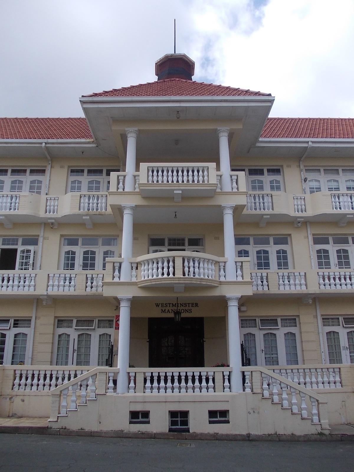
Our route took us eastwards from the City Hall on Rissik Street along Albertina Sisulu Street through the older working class suburbs of Jeppe, Lorenzville and Bertrams. The ridges lie to the north. Our bus drives through Troyeville and we take a left turn down Viljoen Street into the dip and rise again towards the Highlands ridge. We snake around the curves of Stewart Drive with its beautiful stone work rhythmic arches. Working our way around the highest and oldest water reservoirs of the city, we pull up outside Westminster Mansions.
Stewart Drive (The Heritage Portal)
Westminster Mansions (The Heritage Portal)
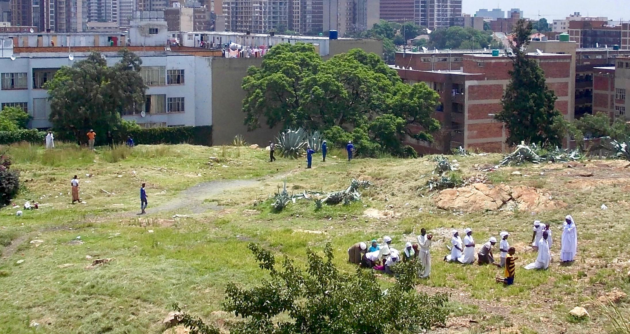
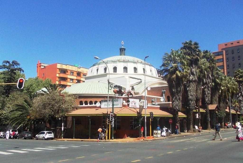
We have arranged to be admitted to the open summit hillside site with stunning views in all directions. The open hilltop has the colloquial title of God's Land, not only because this is where Pentecostal African church groups used to gather for worship and prayer, but also because it is a rare natural city space. The wild tufts of grass blow in the August wind. It is surprising that although these erven are zoned for building, the land has remained empty. Perhaps change is coming as these stands are now owned by the Revelation Church of God of Bishop Radebe. This is a highly successful church that has made its presence felt in the city. It became the new owners of the Great Park Synagogue on Wolmarans Street.
Religious groups used to gather on 'God's Land' (The Heritage Portal)
Great Park Synagogue (Heritage Portal)
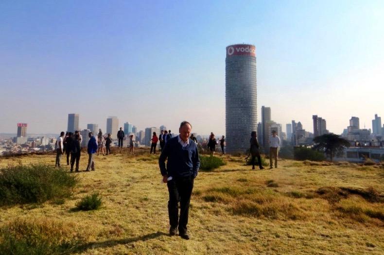
The church has now fenced off and gated the land. The barbed wire is ugly and forbidding. The old shell of a structure next to Westminster Mansions is occupied by the temporary shelters of the security men. Nonetheless we were met by the Reverend Derek of the RCG who gave us access. It became a Kodak wow moment as the city lay before us in the the distance. Ponte looms preposterous and bold, on the far side of Joe Slovo Drive (formerly Harrow Road).
Tour leader Clive Chipkin on 'God's Land' (Kathy Munro)
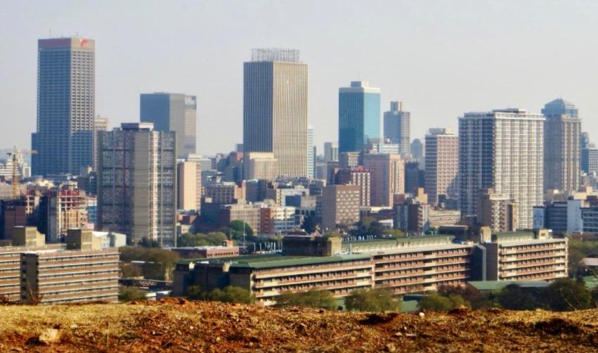
The Highlands / Yeoville ridge is an exhilarating place on a dry August afternoon. No wonder this location was the favourite of filmmakers. The ridge is a superb place, one of the highest points of the city and a natural wonder. In my view, the ridge ought to be kept pristine with Highveld tufty grass whispering to the wind. Here on one of the few stretches of wide open land not yet built upon there is a hint of how the Witwatersrand looked before the emergence of a city.
Johannesburg CBD from the Highland Ridge (Kathy Munro)
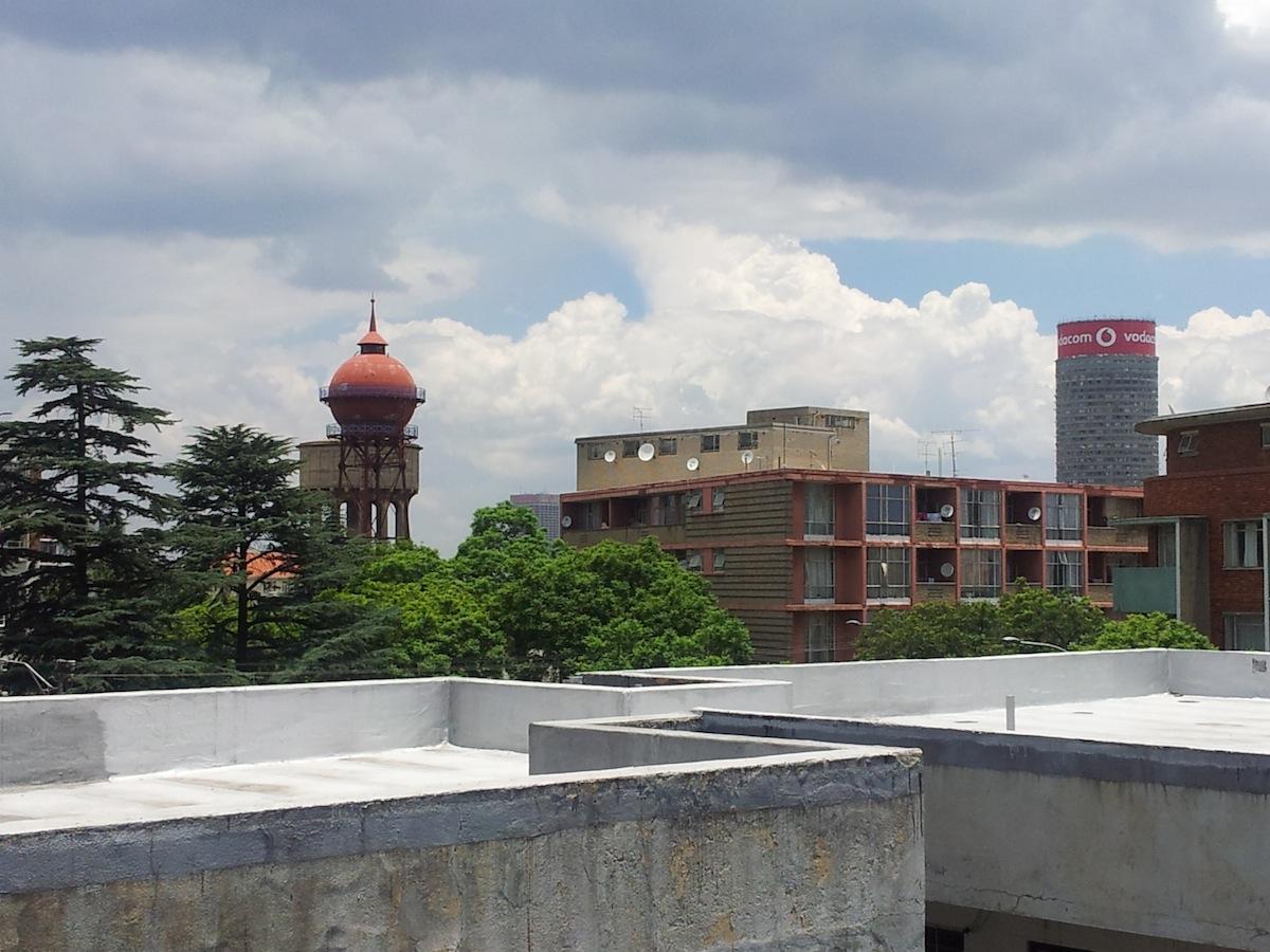
I was struck once again by the defining sense of place. What a piece of ground to reflect on what Johannesburg was and now is. Someone asked "what was here before?". We talked about Hillbrow and Berea and why at a high point on the ridges, the earliest water reservoirs were located. Despite the name Witwatersrand, or Ridge of White Waters, water has always been scarce and it is even scarcer when there is drought. Finding water sources, accessing fountains, channelling water and conserving water became the drivers of great feats of city engineering such as the 1913 iron German water tower and the 1937 concrete water tower erected to improve water pressure) alongside the reservoirs.
Yeoville Water Tower (The Heritage Portal)
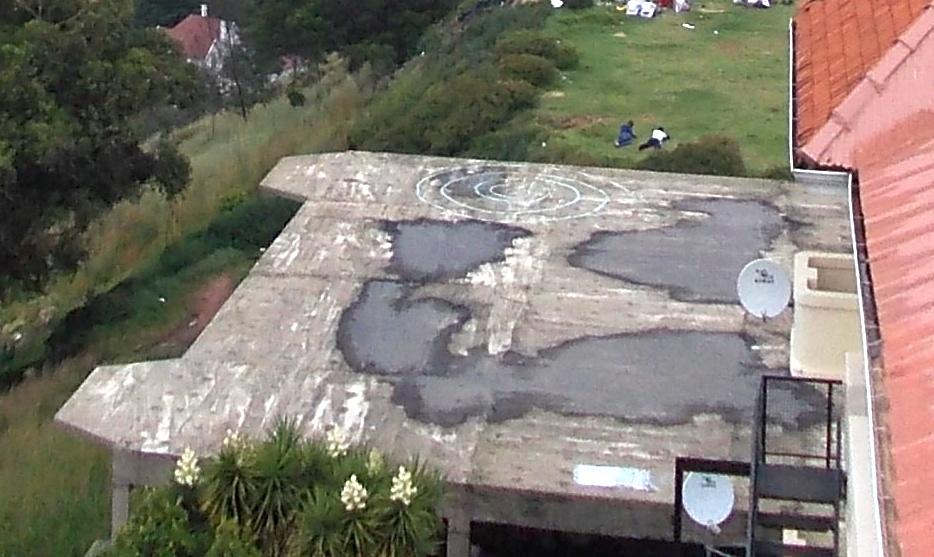
However, I felt a sense of shame to be showing visitors this beautiful ridge when it is now so despoiled by litter and rubble. There is the abandoned shell of a proposed apartment block from the thirties. Planned, but as Chipkin pointed out, never finished, a casualty of depression conditions. This should be a park, an open space where we view our city with pride in changing light throughout the day and night. I guess the city fathers of earlier decades did not think about the preservation of the ridges for parks or the natural heritage factor.
The abandoned shell (The Heritage Portal)
Clive catches our attention and describes the layers of history in all directions:
From the heights of the ridge, look south to the historic CBD where Johannesburg began on the uitvalgrond (between the farms). Spot the slender survivors of the early Victorian town of the late 1880s and 1890s – these were single story shops and, warehouses. Then look at the 1930s skyscrapers - those gems of Art Deco Johannesburg. Now heading towards the fifty year mark are the tower blocks of the sixties and seventies, office blocks, apartment blocks and banks. Hillbrow was a dense flatland, starting as places where white immigrants lived through the years of apartheid hegemony. Those blocks are still there but in the 1980s came a “greying” of Hillbrow and since 1994 there has been a new wave of immigrants to Hillbrow and the city. These immigrants come from South Africa’s neighbouring countries, from Anglophone and Francophone Africa. They come with aspirations and hopes of finding jobs and achieving a better standard of living than back in their own countries. Life in the city gives them a cash income to purchase goods to send home or remit money up north to their families.
Now look North and you have a view across and through the forests of exotic trees to the wealthier northern suburbs. Spot the new high rising Rosebank. Peer beyond and further north to Magaliesberg (old Kashan mts); 60 kms away is Pretoria and the Union buildings and all that symbolized. The Voortrekkers were a northward moving trek force in the 19th century with a vision to roll in their wagons north beyond the Limpopo and to the whole of Africa...
Don’t forget to look west and stretch your eye beyond the Witwatersrand hills to Sterkfontein and were we all began. There you will find the Cradle of Mankind.”
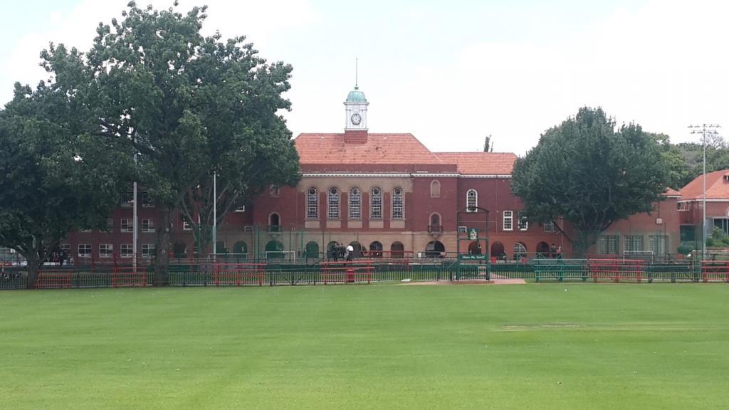
From the crowded pedestrian streets of Yeoville and Bellevue we cross Louis Botha Avenue to the luscious sports fields and old oaks of King Edward VII School, the striking green cricket oval and white woodwork of the pavilion. King Edward VII is a government school that has retained its reputation as a quality school; it is one of those quiet success stories of transition. Founded in the early 20th century, it was named for a British king when South Africa was still part of the Empire. It was originally all white but today it is a highly integrated school. Its object was (and still is) to turn Johannesburg boys into men through sports, a quality education, strong moral values and male bonding.
The school though close to Yeoville is in the far more affluent suburb of Upper Houghton which still has some beautiful period homes. This was Clive's old school and the school of my grandson Cayde. There is a continuity through the Johannesburg generations of boys who are shaped into men on these playing fields.
KES Main Building (Heritage Portal)
Looking at the geography of the city we touch on the complexity of South African issues - we want to get beyond the simplistic catchphrases of black vs white. We want our students to begin to grapple with the interconnectedness, splinter, sub-divisions, sub-clauses, schisms, of class-colour-language-culture-ideologies. In viewing the landscape around us on the ridges, we probe the conceptual and mass nationalisms, political economies, the views from overseas - from the Comintern in Russia, from Washington, from Whitehall in London. How did these international strands play a part in South African history? Geography and landscape enable us to look at the chronology of influence and what ideas mattered most to shape policy in the city and the country. Although Johannesburg was not the seat of government, its status as financial powerhouse meant that the influence of the city was felt in parliament and business boardroom.
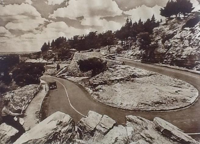
We turn right on Elm Street to head down the precipitous curves of the Munro Drive that descends from the top of the ridge of Upper Houghton to the generous acre stands of Lower Houghton. There is a stopping point at the top of Munro Drive which is a favourite romantic panorama to the north. This pass was made in the 1920s to connect the upper and the lower parts of Houghton (while Upper Houghton had been settled and built upon from the 1900s, Lower Houghton was the fashionable suburb of the twenties and thirties). The engineers cut through the quartz rock of this northern high ridge to make the road with is famous hair pin bend and high retaining rock shear walls. Wrought iron railings are shaped with the old City coat of arms. Munro Drive was named for John Munro, director of JCI and a chair of the Chamber of Mines. It hides some magnificent homes of the mining elite of Johannesburg. The view north stretches over Killarney and out to Rosebank with all the Houghton acres at your feet.
Munro Drive (City Publicity Brochure from 1936)
Property developers are currently hard at work in Houghton, demolishing 70 year old homes on those acres. The old 1930s homes with their eclectic architecture are passing into the forgotten past; lifestyles of mansion homes with half a dozen servants are fading. The land has become valuable real estate and denser living in efficient townhouses and condominium units makes for more manageable “lock up and go” lives. The beauty of Houghton is in its woodland feel, gardens and those thriving jacaranda trees. We are two months too early to see jacarandas in their glorious purple bloom.
One error of our tour was that one needs to be aware that one can only make this a stopping point if you come up, rather than go down Munro Drive, but it's the downhill journey that emphasizes the steep descent to Houghton Drive. It is along Houghton Drive, just below Munro Drive that the graciousness of old Johannesburg town planning unfolds.
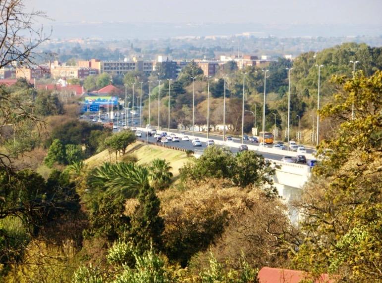
We proceeded along Houghton drive cutting through the now restored Wilds (that is worth a visit on its own) over the M1 motorway streaking towards Pretoria and on to Oxford Road. The story of how the motorway was built in the sixties is another layer of the Johannesburg story when some Parktown estates were expropriated and others were snipped to open land through grand gardens for this engineering masterpiece. The effective result was that urban freeways and the American model made regional business and shopping hubs such as Rosebank and Sandton appealing.
M1 motorway cutting through Parktown (Kathy Munro)
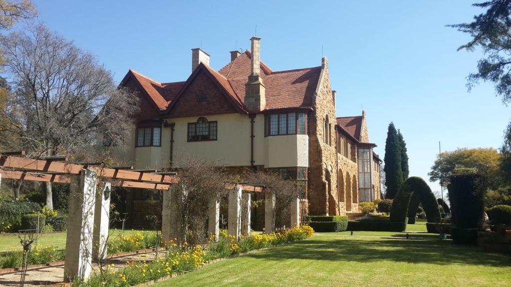
Our next stopping point was Northwards located on Rockridge Road in Parktown. Northwards was the home of the mining magnate Sir George Albu of General Mining for many years. Northwards was designed by Sir Herbert Baker (Baker, Masey and Sloper) in 1904 for John and Jose Dale Lace who lived the patrician country gentleman in the city life until a fire destroyed the mansion in 1911 and the Dale Laces fell on hard times. The house is a magnificent example of a Parktown mansion which once stood in acres of country estate, high above the dust, noise and hustle of the mining town. Baker chose the site well for one of the grandest houses of the new suburb for the wealthy and successful mining magnates.
Northwards (The Heritage Portal)
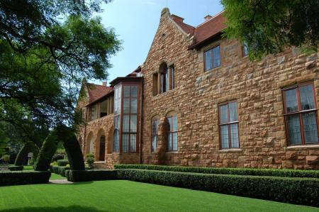
Chipkin, in his book Johannesburg Style refers to Baker describing the site as "on the edge of a virgin kopje north of the town and the mines”. Van der Waal comments that the terms "prospect" and "aspect" were architecturally important with the architect designing for the Southern Hemisphere and a north facing orientation and for Northwards a panoramic view over Saxonwold and towards the Magaliesberg. The Dale Laces sold their ruined mansion and the Albus rebuilt and restored it. Today the glory of the house, the manicured gardens and the view is still there even if the era of the Randlords has passed.
Another view of Northwards (The Heritage Portal)
We were warmly welcomed by Neil Viljoen the passionate curator of Northwards and its history. Neil conducts group tours of the house, arranged through the Johannesburg Heritage Foundation. A Brown University group photo moment in the garden was part of the experience. I discovered the garden sundial in a secluded spot. The scent of the lavender stayed with me for hours. It's a winter garden in August sunlight but the day was hazy. We were invited in to catch the best view possible from the first floor front balcony.
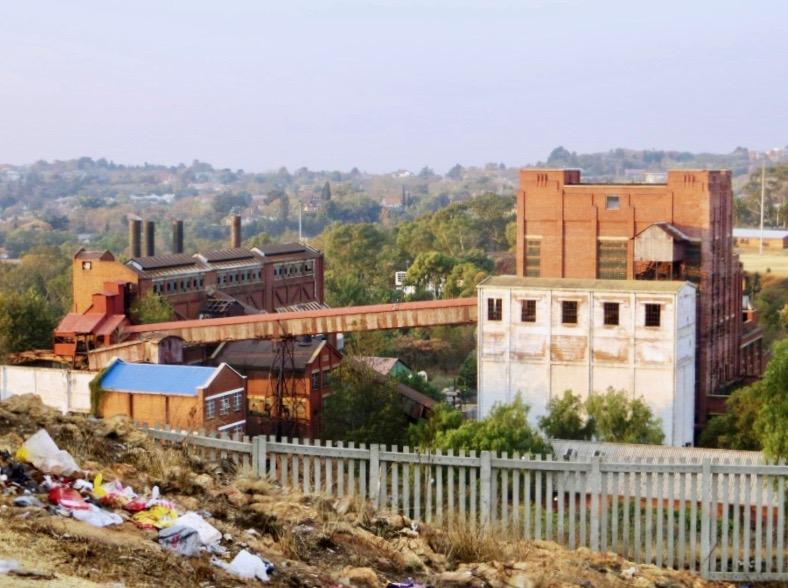
Our bus continued on its route through Parktown. Crossing Jan Smuts avenue we headed into Parktown West taking a left turn close to Barry Hertzog to access the inner western suburb of Cottesloe. We passed the Johannesburg Gas Works, now Egoli gas, a soaring empty cathedral of industry dating from 1928 and built on what was called the Braamfontein Werf. The final stop was on the Cottesloe hill.
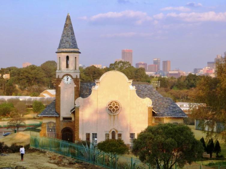
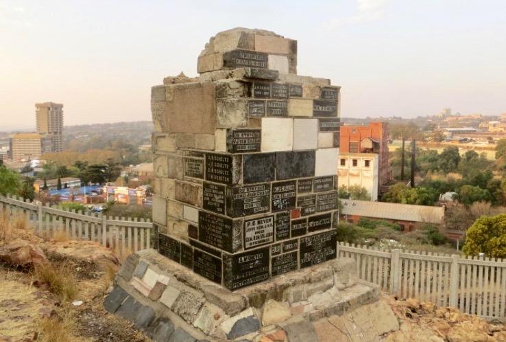
Here one has an excellent view over the City. The city centre is perhaps 3kms away but this time it's a view from the West. Another style and period and cultural strand in Johannesburg history that lies close by is the Hervormde Kerk by Gerhard Moerdyk built in 1935. It has a domestic gable but expanded to church proportions shadowed by a steepled bell tower (this was a 1946 addition). There is also a neglected and decaying memorial to the Ou Stryders, the Afrikaans Boer men who fought on commando in the first and second Anglo Boer wars. Stone plaques set on a tapering obelisk recall family names and period of service. Here is yet another layer of history to be explained. This memorial was unveiled in 1938 and ou stryders themselves or their families prepared their memorials on granite, slate or sandstone plaques for incorporation into the memorial. The context was the 100th anniversary of the Great Trek. The memorial was unveiled by a former mayor of Johannesburg.
The Moerdyk Dutch Reform church with the city behind (Kathy Munro)
The Ou Stryders Memorial on Cottesloe Hill. It is crying out for restoration. (Kathy Munro)
Sadly the hillside which could also be a city tourist site is covered by rubble and litter. Nevertheless, it gives a great view over the Gas Works. We return to our bus and get a view over the poverty that now exudes from Fietas / Pageview / Vrededorp back yards with slum shanties. We pass a street where rubbish is being recycled and sorted. These men with their home made trolleys and canvas bags gathering the debris of modern urban living are the new heroes of the city suburbs.
View over the Gas Works (Kathy Munro)
It was a delight to have an interested curious group of students asking intelligent questions about the evidence you see in houses, apartment blocks, backyards and grand gardens. We had questions about why the high walls, how do you see behind the walls, why the many signs up for armed security responses etc.
This tour shows us the beauty we have in our koppies, panoramic vistas, layering of historic architecture, complex strands of migrant history and unique geology. I weep for our city when I take young visitors from abroad around. We have at least a half a dozen potential world heritage sites, natural and cultural. Johannesburg is still a place of prospects, hopes and dreams for new migrants, younger generations and new cultures.
At the end of the tour the students presented us each with a Brown University certificate of appreciation. What a lovely gift from our visitors!
Thank you to Clive Chipkin and Brown University.
Kathy Munro is an Honorary Associate Professor in the School of Architecture and Planning at the University of the Witwatersrand. She enjoyed a long career as an academic and in management at Wits University. She trained as an economic historian. She is an enthusiastic book person and has built her own somewhat eclectic book collection over 40 years. Her interests cover Africana, Johannesburg history, history, art history, travel, business and banking histories. She researches and writes on historical architecture and heritage matters and is well known for her magnificent book reviews. She is a member of the Board of the Johannesburg Heritage Foundation and is a docent at the Wits Arts Museum. She is currently working on a couple of projects on Johannesburg architects and is researching South African architects, war cemeteries and memorials.
Comments will load below. If for any reason none appear click here for some troubleshooting tips. If you would like to post a comment and need instructions click here.


