Disclaimer: Any views expressed by individuals and organisations are their own and do not in any way represent the views of The Heritage Portal. If you find any mistakes or historical inaccuracies, please contact the editor.
Over the coming months we will be publishing a series of articles, compiled by Peter Ball, on the history of Southern African railways. The first installment looks at some of the earliest railways in the country and the extension of various lines into the interior (driven by the great mineral discoveries of the second half of the nineteenth century).
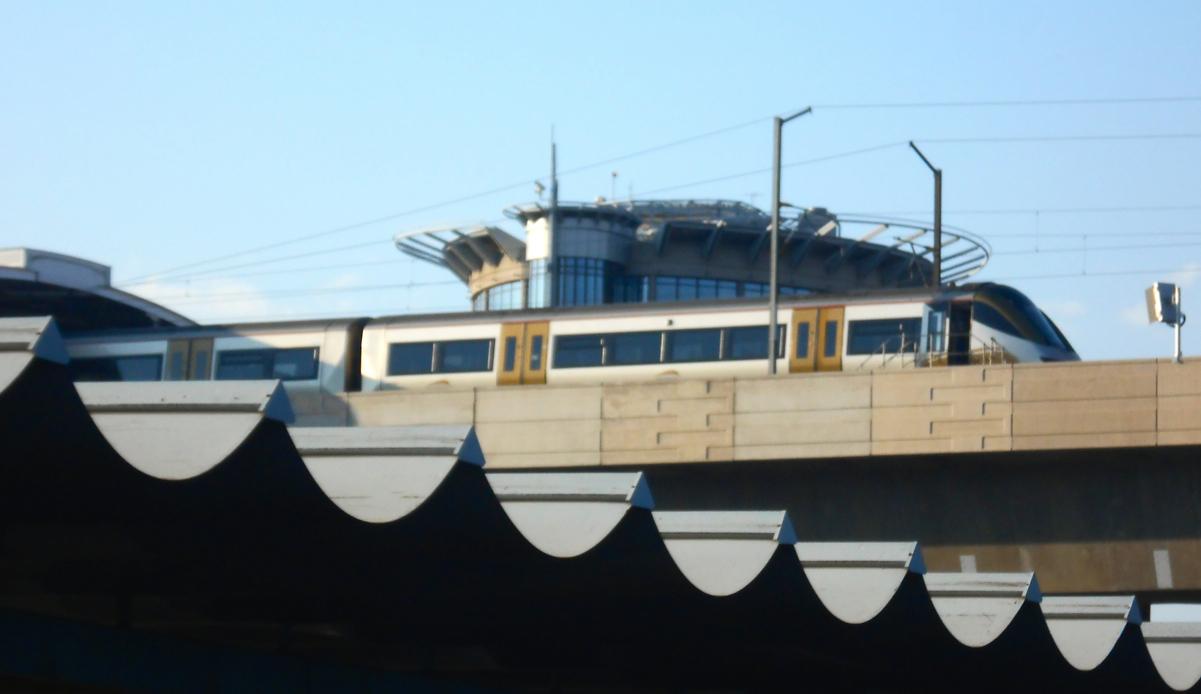
The Gautrain which now runs between Johannesburg and Pretoria was opened in stages commencing with the spur from Sandton City to O.R. Tambo Airport, which started running at the time of the 2010 Soccer World Cup. It was built as a high speed commuter train service having interchange stations with the existing Metrorail system. As the speed of a train was required to be 162 kph (100 mph), the latest railway technology, as tried and tested in Britain was incorporated into the design brief. Part of that brief was to base the Gautrain carriages on the "ElectroStar" electric multiple units already in use on the London outer suburban services. Britain's mainline railways run on tracks having a gauge of 1435 mm (4'-8 ½") between the rails (known as the Standard Gauge), whereas in Southern Africa the gauge is the Cape Gauge of 1067mm (3'-6"). The "Gautrain Rapid Rail Link: Planning and Implementation Study" evaluated the two gauges and recommended utilising the Standard Gauge on the grounds of safety (at speed) and ease of procurement of rolling stock, thus reverting back to the gauge used by the first railways built in Southern Africa.
The Gautrain at OR Tambo Station (The Heritage Portal)
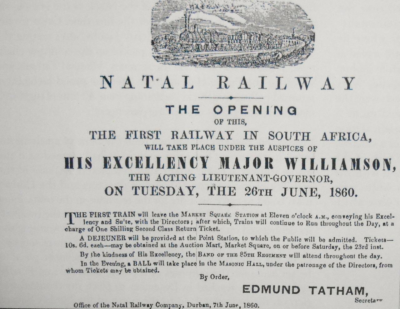
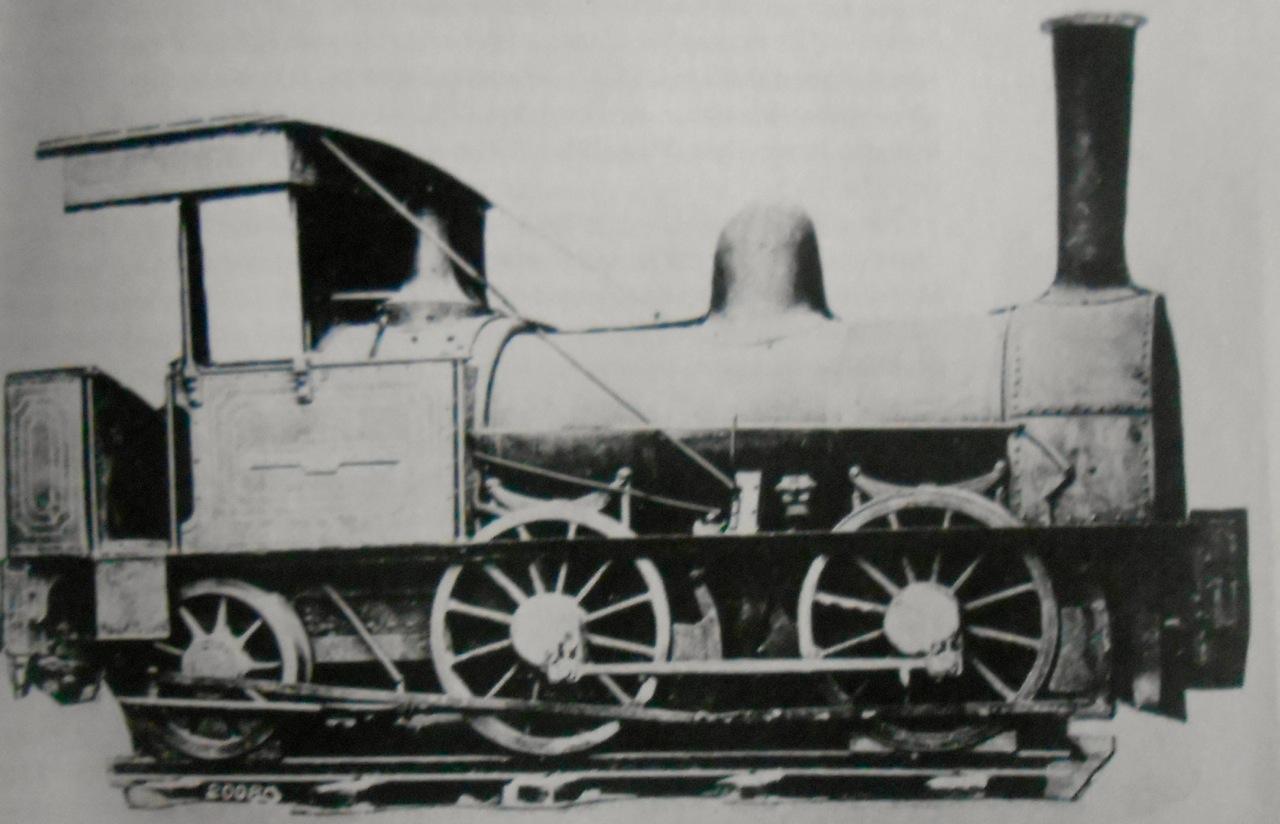
One hundred and fifty four years ago the first railway in South Africa - the Natal Railway, was opened, on the 26th June 1860 and it ran a distance of 2 miles (3.2 km) between Market Square Durban and the Point. As Natal was a colony of Britain it was built to the Standard Gauge. At the same time the Cape Town and Wellington Railway (CT & W), was also under construction and because it was a much grander undertaking, being 58 miles long, it took longer to complete and only opened in November 1863. The line was also built to the Standard Gauge.
Notice in the Natal Mercury 21 June 1860 (Cape Archives)
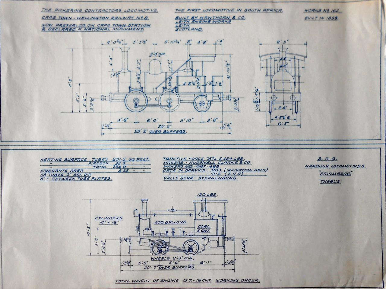
The Steam Engine that ran on the Cape Town and Wellington line
Plans for the steam engine pictured above (Peter Ball's Private Collection)
The use of the Standard Gauge had followed on from the general practice of Britain, where George Stephenson, had laid down the gauge of 4’-8 ½” when building the Stockton to Darlington Railway in 1825 (as previously used by the collieries). Thereafter all rails laid were to the Standard Gauge, excepting for the Great Western Railway (initially between London and Bristol), which under the auspices of its Engineer, I.K. Brunel, chose to use a Broad Gauge of 7’-0 ¼” (2.14 m). In the years up to 1860 every major city in the realm had been connected by rail; the time was to be known as “the Railway Mania”.
Cape Town was the main port and centre of commerce in the Cape Colony and the CT & W Railway was built, to cope with its local traffic needs, both goods and passenger. The line ran from Woodstock eastwards towards the mountains and on reaching Paarl it turned northwards running parallel with the mountains to terminate at Wellington. The traveller wishing to go further “up country” would then have to continue his journey by an animal drawn wagon and take the road up the Bainskloof Pass (opened in September 1853) which was the gateway to the North.
It was to be the providential discovery of diamonds in 1869, in a region 625 miles (1000 km) north east of Cape Town that saved the economy of the Cape Colony from ruin, as in that same year the opening of the Suez Canal had taken away Cape Town’s role as the “Tavern of the Seas”. It was a classic case of one door opening as another closed.
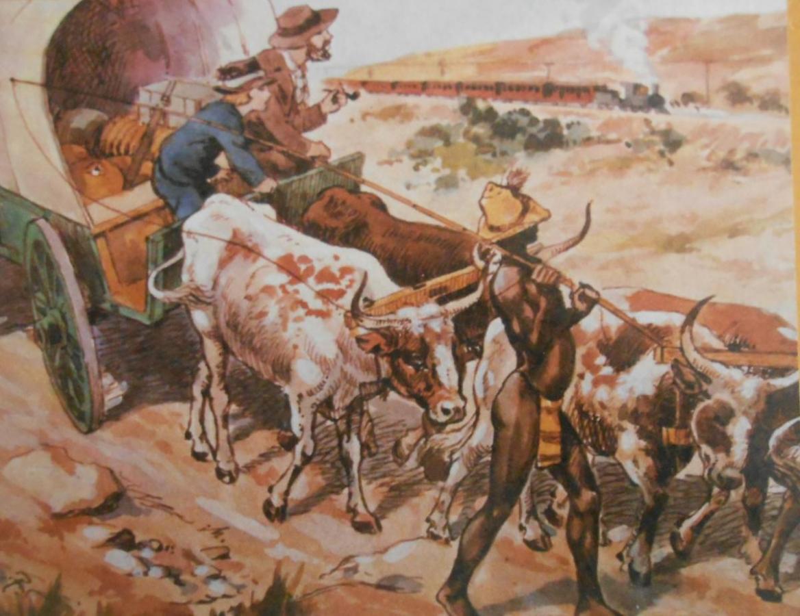
The diamond diggings, which were first known as the New Rush would later become the town of Kimberley; the diamond fields were proclaimed in the area inhabited by the Griqua People, which hastily became a British Colony (Griqualand West) in 1873, and was eventually annexed by the Cape Colony in 1880. Kimberley was a magnet to fortune hunters from all over the world, but to get there was far from easy as there were no paved roads, only trails which crossed the arid Great Karoo. The modes of transport were generally by stage coach, wagon, pack animal or on foot and the Cape Government sought to improve the transportation of goods and people by building a Railway; nevertheless it must not be imagined that a breakneck race in railway construction ensued. Despite the need for quicker transportation events moved slowly at first and it was not until May 1872 that the Cape House passed legislation to enable the Cape Government to take over the CT & W and extend the line further inland, thus creating the Cape Government Railways (CGR). All railway development henceforth would be co-ordinated by the Cape Government.
The geography of Southern Africa differs markedly from that of Britain, as the hinterland of the sub-continent is on a plateau over 1000 m above sea level. This lie of the land determined that the gauge for further railway expansion would be a narrower gauge than “Standard”. The proposed extension of the line from Wellington to Worcester was to be via Gouda and Wolseley, through the Breede River Valley and was subject to the findings of a report, the full title of which was “REPORT of the Select Committee appointed by the House of Assembly on 20th of May 1873 on the Question as to what GAUGE should be adopted on the LINE OF RAILWAY from WELLINGTON TO WORCESTER”. The findings were that a railway with a gauge of 3’-6” should be laid for the extension to Worcester and that 3’-6” should be made the standard for the Cape Colony in the case of all new construction, hence the term “Cape Gauge”. The existing line would become duel gauge with a third rail laid to allow the running of Cape Gauge rolling stock. The decision to use the Cape Gauge was warranted on both civil engineering and economic grounds as earthworks could be smaller, the cross-ties (sleepers) could be shorter and the radius of curves could be sharper than corresponding on the Standard Gauge.
As the crow flies Worcester is due east of Wellington by a distance of 25 miles (40 km), however the railway takes a more circuitous route to avoid the Slanghoekberge and travels a distance of 62 miles (100 km) and was opened on 16th June 1876 to great fanfare as it was the completion of the first phase of the line to Kimberley.
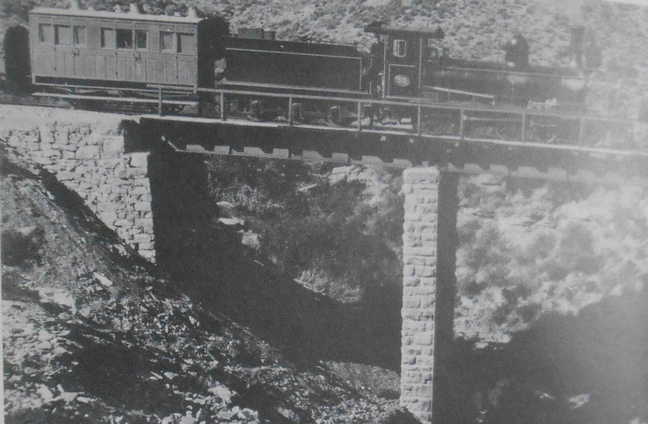
The second phase of the construction was to take the line up the Hex River Valley and into the Great Karoo, no easy task as the difference in altitude in the first 36 miles (60 km), between Worcester and Matroosburg is 2 350 feet (716 metres). It was the duty of William George Brounger, as Engineer to first find the route and then build it to a maximum gradient of 1 in 40. This he achieved by overcoming the difficult terrain especially to the north of De Doorns (20 miles on from Worcester) and he once remarked with a smile that if he could not get over the mountain he would go through it. Later he was awarded the Telford Medal by the Institute of Civil Engineers for his paper entitled “The Cape Government Railways” which gave a scholarly factual survey of the building of the Cape Main Line.
Viaduct Hex River Mountains (Early Railways at the Cape, Jose Burman)
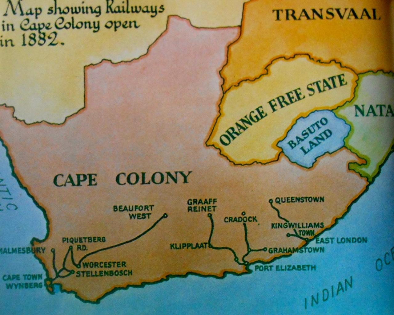
The Cape Government Railways with Kimberley the goal embarked on railway building from the ports of Port Elizabeth (Midland Line) and East London (Eastern Line) with the aim of converging on a junction with the Cape Main Line (Western Line) situated in the middle of the Great Karoo. This Junction was to be first known as Brounger Junction (opened 31st March 1884), but came to be known as DE AAR (the name of the farm where the station stood). The strategy laid down was that not only Kimberely would be reached but also communications (both railway telegraph) in the Eastern Cape would be greatly improved for the betterment of the population living there.
Railways pushing inland (Early Railways at the Cape, Jose Burman)
The Cape Main Line from Worcester to Kimberley was opened in stages so that the railhead could get closer and closer to Kimberley, thus reducing the length of journey by coach or cart. Eventually it was opened throughout on 28th November 1885, even though the last 75 miles (120 km) from the Orange River Bridge was still in an unfinished state. Britain had advanced the sum of £ 400 000 to complete the line with the proviso that it be done within a period eight months! George Pauling was the contractor and it could be said that he invented the term “Fast Track”, as he was laying down track at a rate of 24 miles (39 km) a month.
The following year (1886) was to be the great game changer when gold was discovered on the Witwatersrand (a.k.a. the Rand or Reef) in the South African Republic (Transvaal). The settlement, alongside the diggings, was first called Ferreira’s Camp, but it was not long before the whole world knew it as Johannesburg. Once the extent of the goldfield was proven to be vast and Johannesburg had become established, the goal of the Cape Colony (or perhaps one should say Cecil John Rhodes) was to push the railway through to the Rand. The politics of the time meant that Paul Kruger, President of the Transvaal, was not well disposed to the British colonies to the south and wished instead to promote a railway of his own, independent of British influence. He had plans drawn up for a railway line between Delagoa Bay (Maputo) in Portuguese East Africa (Mozambique) and Pretoria. This did not dishearten Rhodes as he simply changed tack and the extension from Kimberley northwards was destined for Bulawayo in Rhodesia (part of his Cape to Cairo vision), with a possible branch to the Rand allowed for. The main thrust towards the Vaal River and the goldfields would now be an extension through the Orange Free State from the junction at Springfield (O.F.S.) where the CGR Midland Line meets the CGR Eastern Line.
By 1887 the Cape Government Railways’ route mileage had grown from a mere 58 miles (93 km) in 1872 (the original CT & W) to 1385 miles (2215 km); comprising 650 miles on the Western Line (from CT), 335 miles on the Midland Line (from PE) and 400 miles on the Eastern Line ( from EL). In a space of 15 years (1872- 1887) a solid foundation had been laid for the future prosperity of whole of South Africa, even though political unity still lay ahead.
References
- “Railways of Southern Africa” by O.S. Nock
- “Early Railways of the Cape” by Jose Burman
- “Chronicles of a Contractor” by George Pauling
- “The Great Steam Trek” by C. P. Lewis A.A. Jorgensen
Comments will load below. If for any reason none appear click here for some troubleshooting tips. If you would like to post a comment and need instructions click here.

