Disclaimer: Any views expressed by individuals and organisations are their own and do not in any way represent the views of The Heritage Portal. If you find any mistakes or historical inaccuracies, please contact the editor.
Malcolm Wilson returns to tell the fascinating story of an historic road just a few kilometres from the Sandton CBD. He unpacks the layers and personalities associated with Panners Lane and reveals the big changes that have happened in the area over the last few decades. [Originally published in 2014)
Long before the establishment of Sandton as a municipality in 1969, the area was managed by the Transvaal Board for the Development of Peri Urban Areas. The Board developed rudimentary maps and in the absence of names for roads, designated the name Road 202 to what is now Panners Lane. The road branched off Shiel Ave (now Coleraine Drive) and became a dead end near the Braamfontein Spruit.
In the 1920s the Pilkington family ran a popular tea garden named Pilkyvale which was located in what is now Benmore. Later they bought the property located on the eastern side of Road 202. In the late 1940s the family divided the property into four smallholdings for sale to the public.
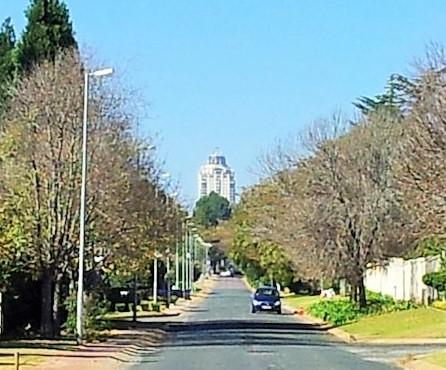
Panners Lane (The Heritage Portal)
The first stand (Riverclub Ext 5) on the corner of Shiel Ave, was bought by Hugh and Florence Walters.
The property was later bought by the Goldfields Mining Group. Various proposals for development including a hotel were considered.
The property fell into disrepair and old stables on the border of Panners Lane were used as a shebeen for some years.
A later proposal considered was to build apartments with a density of 78 units per hectare. This was completely unacceptable to residents in the area and with the assistance of Rose Johnson, the proposal was defeated. In due course the owners of the property agreed to a density of 20 units per hectare and Riverclub Estate was built in 1994.
On the adjoining stand (Riverclub Ext 4), Peter and Joyce Kisch built a large home designed by Stefan Ahrents. Peter was a partner in the long established firm of patent attorneys DM Kisch Inc. The house was named Flint Farm after the artist Sir William Russell Flint who was a personal friend of the Kisch family.
Four dams were built on the small river running below Denys Road. One dam in a fenced off area survives and is owned by the municipality.
Panners Lane in those days was a rudimentary dirt road. Residents were forced to turn out and repair the roads themselves after heavy rains.
Tessa and Denys Roads were constructed in 1981 and named after the Kisch's two eldest children.
David (DAB) Watson the CEO of JCI Mining and his wife Margaret bought the Kisch property in 1968.
After the death of David Watson in 1971, Margaret married Graham Murray, the owner of Murray Pools. Margaret sold half an acre of Flint Farm to Pam Ronbeck (now Wilson) in 1978.
One of Margaret's daughters Elizabeth Dooley owns one of the subdivided properties and has lived in the area since 1971.
After Margaret's death in 2006, the house which had been declared a heritage house, was demolished to make way for the current cluster house development. The name Flint Farm was retained.
Len and Muriel Fisher bought the third 5 morgen plot (Riverclub Ext 33) in 1949.
When the Fishers settled in such a rural area, their urban friends decided they were crazy to bury themselves in such a remote area and their house was dubbed Fisher's Folly. The name was later changed to Folly Farm when the joke started wearing thin
Len was a founding partner of the patent attorneys Spoor and Fisher. He was a Democratic Party councillor for Johannesburg for a number of years. After the death of Muriel in 1984, Len married Audrey in 1986. Len died in 2004 and Audrey in 2007.
Part of the property was sold in 1988 and the complex Humewood Links was developed in 1991. In 2014 Folly Farm (20 Panners Lane) became a cluster house development.
In the 1950s, Fred Pilkington, son of the owner, built a new house on the fourth property and lived there until 1976. He applied for township rights in conjunction with Kingswood Estates which adjoined his property.
The entrance to Kingswood Estates was at the end of Panners Lane and was owned by a woman who later emigrated to England. The property stretched down to the Braamfontein Spruit. A market gardening farm was developed and managed by a Mr Gouveia until the late 1960s. The house on the property was unusual in that the walls contained a façade of pebbles set into the plaster
In the 1940s and 1950s, access to what became Panners Lane was via Parkmore which was undeveloped. A few small shops in Eleventh Street, a sprinkling of cottages in Fourth and Fifth Streets and the defunct Driefontein School were the only existing buildings. The old school building stood out on the crest of Parkmore and served as a site office for Roberts Construction who built most of the houses in Parkmore. The building was demolished in 1961.
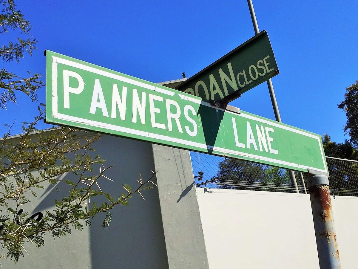
Road 202 was a dust road and later acquired the name Tsessebe Road. All the other branch roads were given the names of buck, Oribi, Suni, Roan, Oryx, Duiker and Sable.
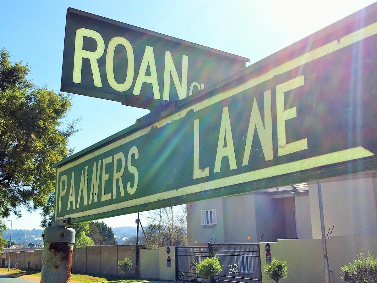
Intersection of Panners and Roan Close 2014 (The Heritage Portal)
Nyala and Gnu Roads were incorporated into Riverclub Estate. Impala Road was absorbed into Humewood Links.
The residents of Road 202 objected to the name Tsessebe as they wanted some record of the original discovery of gold in the Braamfontein Spruit in the naming of the road. After many suggestions such as Goldfinders Lane or Marais Lane, Jonathan Fisher, Len and Muriel Fisher's son, came up with the name - Panners Lane.
Then came the battle to have the proposed name recognised. Efforts by Len Fisher to have the road named under the Peri-Urban Health Board failed. Sandton became an independent town in 1969 and in 1973, the matter was taken up by the Ward 3 Ratepayers Association and eventually passed by the Council. Even then there were delays as the Provincial Administration had to sanction the new name.
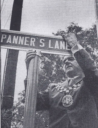
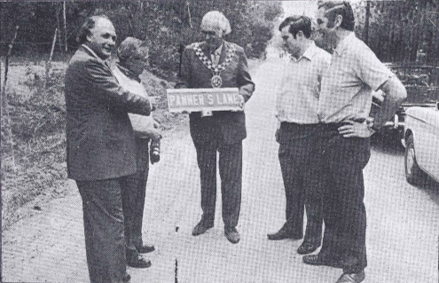
It was not until 22 February 1975, that the Mayor of Sandton, Clr. Bill Hedding, Major Reuben Sive, Chairman of the Sandton Historical Association and Len Fisher, put up the metal nameplate at the corner of Shiel Ave (now Coleraine Drive) and Tsessebe Road, that Panners Lane was formally named.
The Opening of Panners Lane (Sandton Chronicle)
Another Shot of the Opening (Sandton Chronicle)
The local residents, their children, dogs and bicycles crowded the road and after the ceremony and speeches, everyone went for a braai at Margaret Murray's house. The Sandton Chronicle carried the story in full with photographs, including one of the Mayor re-enacting the panning of gold. The November issue of the same year carried a photograph of Jonathan Fisher with his bride on their wedding day standing below the sign Panners Lane.
Panners Lane was finally tarred in 1980.
In 1988, the Transvaal Provincial Government announced a proposal to establish a major link road between Randburg and Alexandra township. The intention was to open the Randburg CBD to become an important commercial and retail hub with good road access from east to west.
The project called the PWV3 or South Road Development, was intended to cross the Braamfontein Spruit at the Field and Study Centre, through the gum tree park at the bottom of Panners Lane, over empty land (now Savannah), the border of the River Club Golf Course and on to South Road Morningside.
Under the leadership of Carlo Chelazzi, the proposal was fiercely fought by property owners throughout Sandton. In 1993 the Province backed down and the project was cancelled.
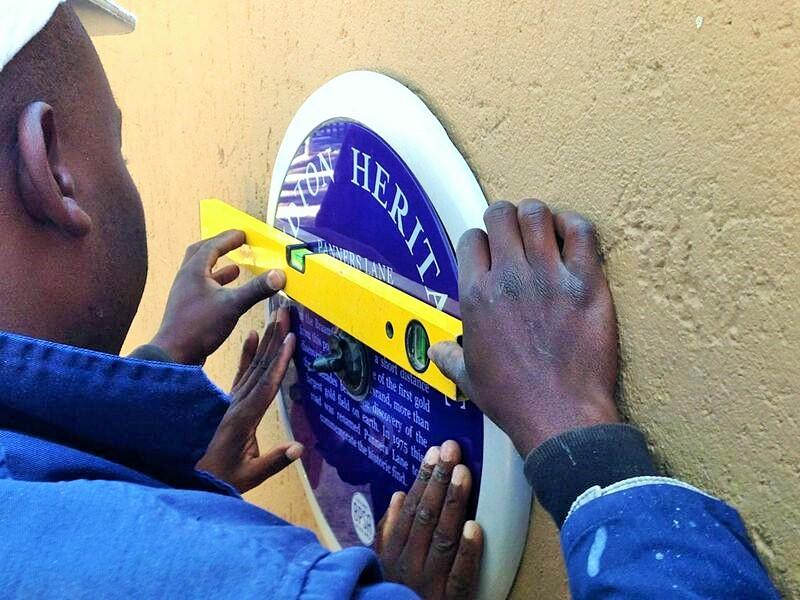
In 2015, largely due to the impact of Malcolm's research, a blue plaque was installed on Panners Lane to commemorate the discovery of gold in the Braamfontein Spruit in 185. (Image - The Heritage Portal)
Comments will load below. If for any reason none appear click here for some troubleshooting tips. If you would like to post a comment and need instructions click here.

